Sunday, December 18, 2011

The Tennessee Valley Authority

I was reading some more in my largely inherited home library the other day, and I ran across a 1939 Americana Annual for the Grolier Society. It had an article on the TVA from which most of this post material is derived.  I have no idea how accurate or current it was in 1939, but it was probably pretty close.

According to the Grolier Society, it was the great American depression era and President Franklin D. Roosevelt was engaged in a host of solutions - the most famous of which was the New Deal.  But really the New Deal was a conglomerate of policies and programs all making up the total package. 

One segement of the New Deal was the Tennessee Valley Authority (TVA).  It was conceived first as a water management and shipping program for the Tennessee River and tributaries, but went quite a bit farther when all was said and done.  Probably the most interesting aspect of this idea was its approach - it was written to be a new federal agency that had the authorities of government with the structure and operations of a private business.  Best of both worlds?  Anyway, Congress bought in and passed this hybrid entity on May 18, 1933.  Between 1933 and 1939, $231,066,270 was appropriated by Congress to implement the legislation.  From the Annual:

"The objectives stipulated in the act are:  Improvement of the navigability of the Tennessee River and the provision for flood control in the Tennessee and Mississippi Rivers; provision for the agricultural and industrial development of the Tennessee Valley; provision for the national defense; and the development and distribution of incidental hydroelectric power to the public."

The rest of the article goes on to tell what the TVA was involved in between its inception and 1938.  The first statement says:  "control of the water resources of the region implies control of water on land, with consequent checking of erosion, improvement of agricultural conditions, retarded flood runoff, and increased groundwater storage."  The TVA was also involved in two Nitrate plants, massive tree reseeding operations, malarial research, the study of occupational diseases, development of freight terminals, the installation of hydroelectric plants, the planned building of nine dams, experiments in developing large cooler containers and various ag pursuits including improved cottonseed oil production, high quality sorghum syrup, better flax fibers for cotton textile equipment, electrical curing of hay and dehydration of sweet potatoes.

They even dabbled in public water supply improvements like the single water supply for Wilder, TN in 1942. (Shown below) 


The operation of a governmental entity under private corporation practices did seem to provide a learning curve, though. It wasn't long before the TVA was being federally investigated over allegations of its business practices and accounting, and its director, Arthur E. Morgan, was dismissed by President Roosevelt for "contumacy" when he refused to answer questions about a land deal involving a Senator. Anyway, I find the water issues related to the TVA far more interesting.

I had to chuckle a bit when I discovered the editors for the 1939 Annual to be McDannald and McDonnell, and other contributing editors included McGrail, McKinney, McMahon, McMahon and McNinch.  It's surprising they didn't get the company name changed to McGrolier.


Thursday, December 15, 2011

Fracking in Kansas - KGS Rendering

The Kansas Geological Survey (KGS) has created a hydraulic fracturing (fracking) page on their website with a fairly complete synopsis of fracking in the state of Kansas.  They come to the conclusion that fracking in Kansas is not that big of a deal - environmentally - due to the unique geology we have, the abundance of deep injection disposal wells and a Corporation Commission that has regulated the industry for many years.

However, they continually use wording that leaves a lot of wiggle-room, such as "..Fracturing jobs are normally engineered to restrict the fractures to the target formation."  and   "..Although in most cases only a limited number of additives are used.."  and many, many more such examples.  The bottom line, as I have said before, is that if done under the right conditions in the right way, it likely is not a huge risk.  But I'm not sure every state and every operator understands what all these conditions and procedures are.  I'm also not sure the state regulators are keeping up adequately with the advances being made by the producers which KGS says are prodigious.

Anyway, KGS is to be congratulated for the posting of this material.  It is a very good overview containing a ton of basic information from which more meaningful public discussion can continue.  It has also provided me the background to ask the regulators and the industry several more specific questions that I hadn't thought of before.  We all need to insure that the extraction of oil and gas is done responsibly.  On this point I think everyone agrees.

Wednesday, December 14, 2011

Early NW Kansas - May 27, 1886 - Life and Hope

I love the old writing style.  The following excerpts have been taken from a long article contained in the May 27, 1886 edition of the Thomas County Cat - Colby, Kansas' first newspaper - page 4.  (Hint:  Keep reading - the water stuff's at the end):

"Prentis on Thomas County.

The objective point of the expedition was Thomas county and the present port for Colby, is a station which formerly bore the name of Cleveland, but is now officially known as Oakley.  From this point a daily stage runs to Colby. If you wish to leave any property to your children, you will take this stage. If you are a reckless prodigal, bent on squandering your wealth as soon as possible ; if you wish to enable a bandit to fix up his cave with oriental splendor, you will patronize an Oakley livery stable keeper. The distance from Oakley to Colby is estimated at from twenty-two to twenty-eight miles, but as an Oakley livery team can make the distance in three hours and have strength enough left to return the next day, it is not much above the first figure.

The traveler who thinks that he realize the high vastness of the plains by looking from the car windows is mistaken.  That is like looking at the ocean from the shore, while he who journeys in a carriage or on horseback is like a voyager in the midst of the deep. Every time this great high country is visited the higher and wider it looks.  It never encourages that familiarty which breeds contempt.

Colby, a town which has attained the mature age of one year, was reached at sunset and was inspected by moonlight and by daylight. It has nothing to mark it as a frontier or even a new town. There is not a sod house or a shanty in the place, not a building of any magnitude that's not painted ; the sidewalks are better than the average Atchison article. The stores sell dry goods and groceries at Commercial street prices. Art, too, has obtained a foothold. The Martin drug store obtained the services of an eastern paper hanger, and now you see his work all over town. We had dreaded the frontier hotel, having experienced hunger and some bloodshed in the course of a day and night experience at such in the past, but we really met, as old Shenstone has it, 'Our warmest welcome at an inn." The Colby House supplied every want or the Champion's commissioners.

The first term of the district court was held by Judge Pratt two weeks ago. In these days when a lot of imported cranks and ruffians are declaring in favor of the abolition of God and the extinguishment of law, it is refreshing to see that the American citizen who deserves the name will not live without law. As soon as possible after a county has settlers, it insists on a district judge and a term of court. Thomas County, with the assistance of Sherman, attached for judicial purposes, mustered a docket of twenty-two cases including divorce cases. The local historian states that the county has had its first marriage, its first baby and its first divorce.

Four thousand people are gathered there [Thomas County] perfectly courageous and confident that they will succeed - if it rains. So far the rain has fallen. We saw the water in pools and there is an added greenness in the draws, the low "lagoons," as they are called, and the old buffalo wallows.

Under this country lies what seems a shallow subterranean lake, deeper in some places than in others. On the elevation of the surface depends the distance to this water varying from twelve feet to one hundred and fifty. The county is dependent for water on the rain and on the wells. The great railroad well at Oakley supplies water for farmers for miles around. How long a farmer will haul water depends on his enterprise. We saw a farmer at the well who did not come for water : he had just reached water on his claim at the depth of fifty-six feet. So the rain comes down and the wind mill pumps lift the water to the surface, and the sod is turned over at the rate of hundreds of acres every day, and men believe that agriculturally they are "all right" in a country without a river and without a tree, and may the Lord who raised up for our benefit Stowell, and Lessenger, and McGonigal and Worcester, and the rest of the good fellows at Colby, grant that there may be no disappointment."

Some things are very apparent:

1)  Prentis was obviously charged too much for his livery needs in Oakley! 
2)  He is enthralled by the vast, open plains and doesn't mind the newness of the area.
3)  He very much likes Colby and is a strong law and order person.
4)  He appreciates and understands the importance of water to the area - in any and all forms.

Thanks for reading.  BTW, also on page 4 is a letter to the editor by a local farmer who has come to town and was quite unimpressed with the meal he got from the local eatery.  Funny stuff as well.

Tuesday, December 13, 2011

Fracking and Pavillion, Wyoming

Well the EPA report on the Pavillion, Wyoming groundwater contamination claims has just been released after 3 years or so collecting water samples, production data and evaluating everything.  It isn't comforting to find that EPA thinks the vertical fracking activity and the production operations have both been responsible for some fairly significant groundwater contamination at this location.  The list of chemicals in the groundwater, while predominately methane gas as initially claimed by the residents, is reportedly lengthy.

I was surprised to find that the hydrocarbon production was as close to the usable groundwater as it was.  Most of the drinking water wells in the area (within 4 miles of the production wells) were completed anywhere from 400 feet to 600 feet below land surface.  As nature would have it, the geology is quite complex there due to all the folding and faulting the area has experienced throughout its geologic history.  It is this very geologic activity that has provided all the hydrocarbon traps that are being produced today.

I was also surprised to see the stratigraphy map of the area (click graphic to enlarge). There is not a single confining layer in this rendering that is not listed as a "leaky confing layer".  This means that there are no real confining layers at all in the entire vertical section.  I have to ask what the company geologists thought might happen as they fracked and produced natural gas literally 500 feet or so under the groundwater being used by the residents.  According to EPA, of the 160 or so production wells in the area, only two had the appropriate amount of production pipe installed and cemented.  Not only that, but most of the cement bond logs found incomplete and inadequate cementing jobs of what production pipe was installed. 

The production company is aggressively lambasting the EPA preliminary report, which has not been through peer review yet and made final.  The company says that:

*  the peer review process will conclude that EPA's drilling and sampling process was faulty and resulted in the apparant contamination found in the deep wells;

*  that no man-made chemicals used in the fracking process have been found in excess of water quality standards; and

*  EPA ignored well known geologic and hydrologic conditions of the Pavillion field.  They conclude that EPA's release of this preliminary report was grossly irresponsible.  And the debate goes on.

My read is that whatever is ultimately concluded, the fracking and gas production in Pavillion will continue (there are only 161 persons using the groundwater within 4 miles of the site), and will continue everywhere else, too.  For sure, the geology and hydrology at Pavillion is very different from everywhere else, and even if the conclusion here is that mistakes had been made, it doesn't necessarily follow that mistakes will be or are being made everywhere else or anywhere else.  Every area will have to deal with these issues on their own.  The energy is simply too important (and let's not forget valuable) to do otherwise.  Besides, we can always clean up the water if we have to. (Ouch!)  Mind you, this is my read, not necessarily my opinion. 

My final point is regulation. There are those calling for federal regulation by EPA of all fracking activity.  The oil and gas industry is vehemently opposed to this approach, which makes most think it probably is the right one.  But I think the individual states can do this better - IF each one of us makes sure their state is appropriately addressing the public concerns.  I still think it is easier to make state regulations do what they are supposed to do when they are inadequate than federal regulations if they miss the mark. 

But one thing is for sure, someone needs to step up with a set of regulations that adequately protects the drinking water.

Monday, December 12, 2011

Groundwater On Times Square

OK, so the Heads UP folks have conducted a visualization contest for groundwater decline issues - to be aired on world water day (March 22, 2012) in Times Square, NYC.  The call for entries asked that people take actual USGS groundwater data sets and render that data in visually striking and creative ways.  The winner is to have his or her creation splashed onto the Nasdaq and Rueters big screens in Times Square on world water day.  Is this all aimed at driving home the message of groundwater declines worldwide or to create interest/concern/fear/outrage and hence public reaction?

The winner was announced on December 7 and he is Richard Vijgen, an information designer from the Netherlands.  His renderings are definitely cool (you can see them here) but just how practical they will be and how well they will express the world's groundwater conditions remains to be seen.  They are 30 seconds each in length, to cover what appears to be a tremendous amount of data.  They go by so fast I can't glean anything more than since 1911 the groundwater in many parts of the world has declined to some degree or another.  I do get a sense of an accelerated decline rate in some places, but it doesn't really sink in because I can't relate the various bars to any specific world location.  You just can't see the lables used on the video.  Now maybe if I was in Times Square... (hint, hint)

Call me old fashioned, but I'd rather just see the data presented as a simple line graph over time by location.  I know, BORING!!!  But I do think a message will be sent that may translate into at least increased public awareness.  But everyone should know, there are entities - like my very small groundwater management district - that are working on these problems every day of the year.  Had we been provided part of the money used to conduct this contest I guarantee you our problem would be a little less onerous than yesterday.

Thursday, December 8, 2011

Nitrate Management That Works

Nebraska farmers like to grow corn - period.  They like it so much they were not adverse to applying upwards of 200 pounds of nitrogen fertilizer or more per acre on a routine basis in the 1960's and 1970's.  As you might expect, in the sandier soils or where groundwater levels were fairly shallow a nitrogen buildup began to occur.  Nowhere was this more advanced than in the Central Platte Natural Resources District (CPNRD).  In several areas of this NRD nitrate-nitrogen levels in the groundwater were increasing on the order of .5 ppm per year, and were in excess of 25 ppm.  Recall that the federal standard is 10 ppm.

The CPNRD chose to act in the mid 1980's with the regulations for a sophisticated nitrate-nitorgen management plan in any NRD area that exceeded their trigger criteria.  The program actually uses three phases based on ambient nitrate-nitrogen levles with each successive phase having stricter requirements.  The overall plan called for reductions in fertilizer applications by several methods - monitoring groundwater levels and subtracting this source of nitrogen from application rates, education on more optimum nitrogen applicaton rates, restricted application times and the power of positive reinforcement - if the area's nitrate rates start falling, additional monitoring can be averted.

Bottom line, most of the areas are seeing a reversal of trends.  On average, the NRD pre-program rate of change was an increase of nitrate-nitrogen of about .5 ppm per year.  Today, most areas are seeing a trend of a .25 ppm decrease per year.  On the broader scale, the once average concentration of 19+ ppm is now about 14.5 ppm.  And it was all done without sacrificing production levels and farm income.  I guess you could argue that after 20 years or so the groundwater is still above the federal level, but in my opinion that'd be missing the larger point.  I have to congratulate the CPNRD on a program well done.

I'd also be remiss if I didn't mention that this effort is now being done without the data support FSA used to provide - on crop types and acreages and landowner and farm operator information.  The elimination of this data support has caused the NRD significant added expense to keep this program running.  I have blogged on this before here.  It seems a shame to me that the federal government will not help state and local governments with this data support.  'Nuf said.

Tuesday, December 6, 2011

Texas Drought Has a Small Upside

There is no question that the drought in most of Texas is about as severe as it gets.  Starting even in 2009, the 2011 situation is claimed to be the driest since records have been kept (since 1895).  Moreover, it has also been compared to treering data from 1550 , and still ranks right up there.  Now, that's DRY!  As a result, water supplies have been stretched pretty far - especially surface water impoundments of all kinds.

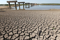
A recent article in the New York Times by Manny Fernandez was an interesting read on some of the things that have been showing up as the lake levels plummet.  Included are:  a 1999 Chevrolet Monte Carlo with the deceased driver still buckled in (missing since July, 2008); a cryogenic tank from the 2003 reentry disaster of the space shuttle Columbia; an 1882 grave marker for a 1 year old infant; a skull from a very old indian male; and some 200 additional archeological sites of various descriptions.

I guess if there is any upside of severe drought, it may be the extra knowledge obtained from checking in on all the foreign and lost items that are in the bottoms of their lakes and rivers that shouldn't be there.  Let's hope the rains return and these hearty folks get back to normal as soon as possible.  The only thing we know for sure is that in another couple of hundred years they'll have another look-see opportunity.

Sunday, December 4, 2011

Forget Fracking - Finally, Fractal Water!

Imploder Shower Head
Another website with incredible claims of Water Power.  This time it is Fractal Water, and what a story is being told here.  This group has invented the Imploder Magnetic Water Treatment Device which works wonders for industrial, agricultural and home water use (and even more as we'll see later). 

From the site:   "The Imploder magnetic water treatment device produces a measurable and validated effect on plant growth, seed germination success, and biomass yields.  It is unique technology that combines a magnetic array with a directional nozzle based on phase conjugate hydrodynamics, combined with phase conjugate magnetics. The extreme converging magnetic flux lines create the centripetal inertia at the liquid molecular level sorting by mass. Resulting in the increase molecular order and spin density."

"Spin density" and "phase conjugation" - now that's what I'm talkin' about.  But there is more techno-speak to be sure.  This tool is a golden ratio (phi 1.618) designed device that employs Fractals, too.  The literature says: 

"Because a fractal signifies infinite compression, it is what spans the gap between the symmetries of the very small and the very large.  Fractals exhibit self-similarity, meaning their inner structure has the same pattern as their outer structure - like a pine cone or a fern tree.  Just as fractality describes the geometry of waves of energy or charge, fractals manifest as wave patterns that evolve ad infinitum - like an encoded thread linking larger spirals to infinitely smaller ones." 

Mind-bending, isn't it?  But that's not all!  Tucked in at the very end of the material is this blockbuster revelation:

"...It also has the ability to create sedimentation thereby converting tar sands into oil production (sedimentation rate increase)." 

That does it for me.  I was about to be satisfied with the home shower device (for enhanced blogging stamina) until I discovered this.  Now my sights are set on the $900.00 needed for a new, Super Imploder and I'm off to find me some tar sands.  Free shipping, BTW.

Friday, December 2, 2011

NY Times Editorial - Ogallala

I ran across an editorial in the New York Times published yesterday (December 1, 2011) that was not very complimentary to water management in the High Plains - state or local.  I felt compelled to comment, but it appears that the NY Times does not value any further discussion as there was no opportunity to do so - odd.  So I thought I'd just blog about it instead.  The title was "Running Dry on the Great Plains" and was written by Julene Bair of Longmont, Colorado. 

I happen to know Julene as she is originally from NW Kansas (Sherman County).  We actually corresponded for a while on groundwater issues and have even discussed said issues in my office a time or two.  I considered Julene to be very thoughtful and she seemed quite diligent in her fact gathering.  The questions she asked me were good ones, but tended to be focused on her groundwater and irrigation experiences in Sherman County - one of the most depleted areas of GMD 4.  I feel I answered her questions honestly but always tried to broaden the scope of where I sensed she was wanting to go - damn all irrigation and reclaim the groundwater to pre-human use levels.  I stressed that all of GMD 4 was not as dire as Sherman County, and, the value of local control was the ability to bring about any outcome the majority of the landowners and water users wanted - as long as they took the responsibility and spent their efforts working on the issues.

If you read the editorial she claims that water controls imposed by local water districts (run by irrigators themselves and by state legislators dependent on the farm vote) have been minimal at best.  She is entitled to her opinion but I would respond that if she's right, it's simply because collectively the locals have not embraced their role effectively enough to do otherwise.  Since our discussions of perhaps 6 years or so ago, GMD 4 has crafted an enhanced management process where local subunits in the district are encouraged and empowered to go well beyond the existing district regulations, which while we're on the subject, had long ago stopped new development, appropriately controlled water right changes, metered all wells, controlled irrigation tailwater and lots more. 

Two such subunits were defined in Sherman County and both of them met twice and then decided to do nothing more.  Over in Sheridan County their subunit is proposing the most aggressive enhanced management proposal yet in the state of Kansas.  I don't think the fact that enhanced management is not happening in Sherman County means that local control is a failure - at least not as much as apparently Julene does.  I guess it could sound like I'm pointing the finger of blame toward Julene and her ilk for not addressing these problems, when I'm sure they're thinking "That's the GMD's job."  I guess the point is that in our local management scheme, right or wrong, it's both our jobs.  The GMD has created the subunit ability to make things happen via local involvement - all we need now are the interested players. 

The only issue I think Julene got really wrong is her claim that we are wasting the water we use - by growing corn which uses fertilizers and pesticides that pollute.  It is clear we're not using water the way she thinks it should be used, but I don't think this by itself constitutes waste.  To most water users, leaving the water in the ground doing nothing is a waste.  The fact is, neither of these uses is a waste - they are both political choices that someone has to make.  Now I return to the issue of local control.  See how important it really is?

Julene, let's keep talking.