OK, so the Heads UP folks have conducted a visualization contest for groundwater decline issues - to be aired on world water day (March 22, 2012) in Times Square, NYC. The call for entries asked that people take actual USGS groundwater data sets and render that data in visually striking and creative ways. The winner is to have his or her creation splashed onto the Nasdaq and Rueters big screens in Times Square on world water day. Is this all aimed at driving home the message of groundwater declines worldwide or to create interest/concern/fear/outrage and hence public reaction?
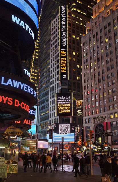
The winner was announced on December 7 and he is Richard Vijgen, an information designer from the Netherlands. His renderings are definitely cool (you can see them here) but just how practical they will be and how well they will express the world's groundwater conditions remains to be seen. They are 30 seconds each in length, to cover what appears to be a tremendous amount of data. They go by so fast I can't glean anything more than since 1911 the groundwater in many parts of the world has declined to some degree or another. I do get a sense of an accelerated decline rate in some places, but it doesn't really sink in because I can't relate the various bars to any specific world location. You just can't see the lables used on the video. Now maybe if I was in Times Square... (hint, hint)
Call me old fashioned, but I'd rather just see the data presented as a simple line graph over time by location. I know, BORING!!! But I do think a message will be sent that may translate into at least increased public awareness. But everyone should know, there are entities - like my very small groundwater management district - that are working on these problems every day of the year. Had we been provided part of the money used to conduct this contest I guarantee you our problem would be a little less onerous than yesterday.
Trying to articulate water issues, provide discussion fodder, seek other ideas, broaden and educate a bit, and, and... well, solve the world's water problems.
Showing posts with label on-line water data sources. Show all posts
Monday, December 12, 2011
Monday, March 8, 2010
Free Water Rights Session Scheduled
We often get calls from folks asking about web data and/or information on water, water rights, water levels, etc. We thought perhaps a series of group sessions about on-line data sources might be helpful. Our first session will be: March 31, 2010; 1:00 PM; in the district offices, 1175 S. Range, Colby, on the Navigation and Use of WIMAS.
WIMAS is the on-line Water Information Management and Analysis System maintained by DWR but housed on the Kansas Geological Survey computers. It contains all the public information relative to all Kansas water rights. In this session you’ll learn how to find the site and use it. There is a lot of information on Kansas water rights here, including reported water use, ownership, authorized rates and quantities and more. The mapping and graphing of the information is also useful.
All we ask is that you register so we can get a bigger room if necessary. Call 785-462-3915 or email rwade@gmd4.org if you plan to attend. Later sessions (if the response supports them) will be on water level data; well completion records; and the High Plains Atlas; and perhaps other water-related sites if suggestions are offered from the participants. If there is no interest in WIMAS the later sessions will be cancelled.
Subscribe to:
Posts (Atom)
